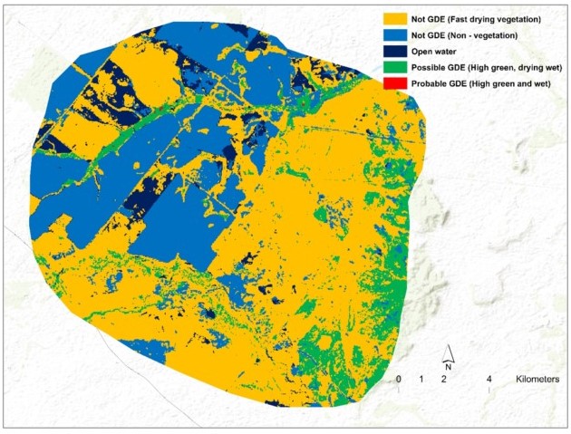
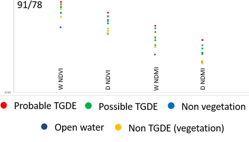
Companies looking to develop coal seam gas or coal resources may be required to locate Terrestrial Groundwater Dependent Ecosystems (TGDEs) within their operating areas as impacts to shallow aquifers may negatively impact on the TGDE. However, operating areas may cover vast regions and the TGDEs may consist of the same tree species as non-TGDE areas and be very difficult to verify groundwater dependence. We worked with a major gas production company to locate TGDEs within defined potential impact regions in Qld. We implemented the remote sensing-based approach described by the Independent Expert Scientific Committee (IESC) using Landsat TM imagery taken during wet and dry periods to identify vegetated areas that appeared to be consistently greener and wetter than the surrounding environment. Areas that were shown to be persistently wetter and greener that the surrounding environments even during very dry periods were mapped as probable TGDEs. Our solution not only used the Federal government recommended method but was able to cover hundreds of thousands of square kilometres in a project that was completed within 3 months