Traditional Paakantyi Language of the Kurnu-Baakandji nation used in this article. (L. A. Hercus – Paakantyi Dictionary).
The Commonwealth Environmental Water Holder’s (CEWH) Science Program funds the Flow Monitoring, Evaluation and Research (Flow–MER).

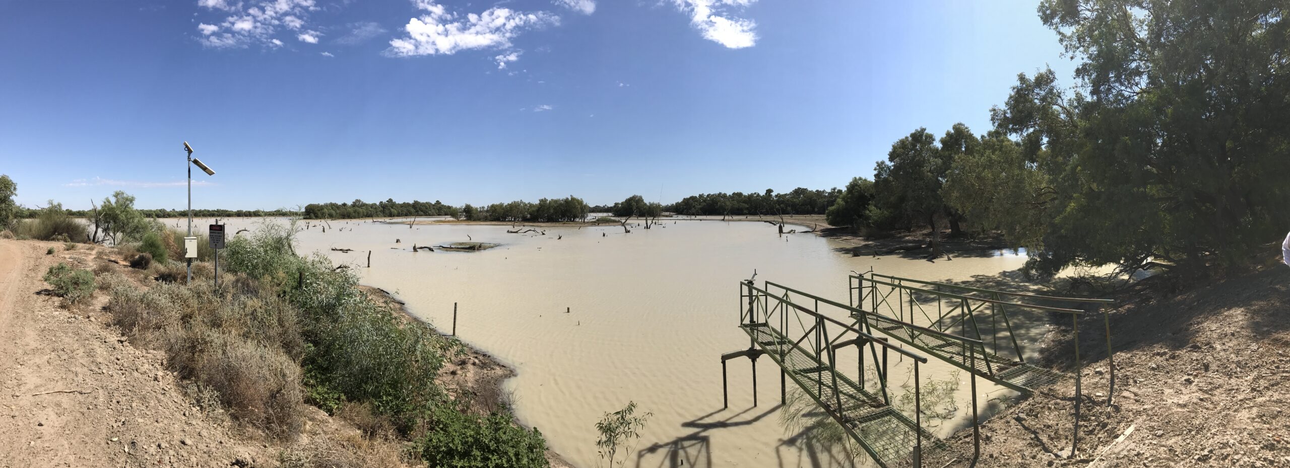
The headwaters of the Warrego River rise in the Carnarvon Ranges of Queensland. From there the Warrego flows across flat semi-arid plains until it meets the Darling/Baaka River upstream of Louth. Just north of its confluence with the Darling/Baaka, the Warrego River is bordered by the Western Floodplains (Figure 1); an extensive floodplain system within the Toorale State Conservation Area.
The Warrego River is ephemeral. During periods of high flow, the Warrego River and the Western Floodplain are interconnected, and water (nguku) flows through the lower Warrego into the Darling/Baaka.
In dry (tharla) periods, the water in the Warrego and Western Floodplain fragments into isolated waterholes. This variability, typical of semi-arid rivers, is likely associated with fluctuations in the abundance of local fish species.
The years from 2017 to 2019 were dry. Floodplain inundation was limited, and many of the dams along the lower Warrego River dried (Figure 2). On 16 April 2019, the only remaining water across the whole of the lower Warrego River and Western Floodplain was one small waterhole in Boera Dam.

From 2021 to 2022, higher flows returned to the lower Warrego River. Upstream rainfall and Commonwealth water for the environment combined to inundate the lower Warrego and Western Floodplain, and isolated waterholes were again connected. With these flows, the observed abundances of many local fish species, such as the Hyrtl’s tandan catfish (Neosilurus hyrtlii), increased markedly.
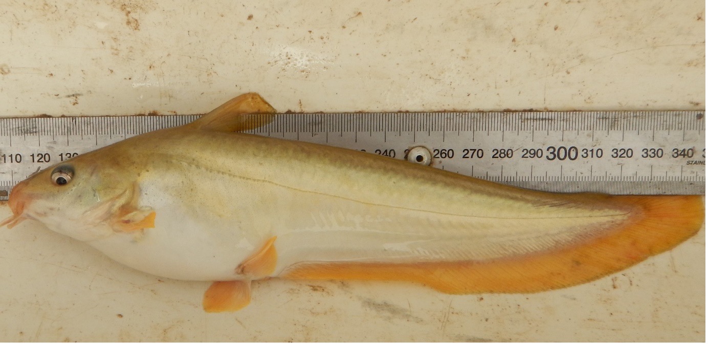
The presence of Hyrtl’s tandan (Figure 3) in the lower Warrego River has been monitored since 2014 as part of the Long Term Intervention Monitoring (LTIM) project and the Flow-MER program. Prior to this, very few studies of fish assemblages had been undertaken in the Warrego River, although a survey completed around 20 years ago reported high abundances of Hyrtl’s tandan in the upper Warrego.

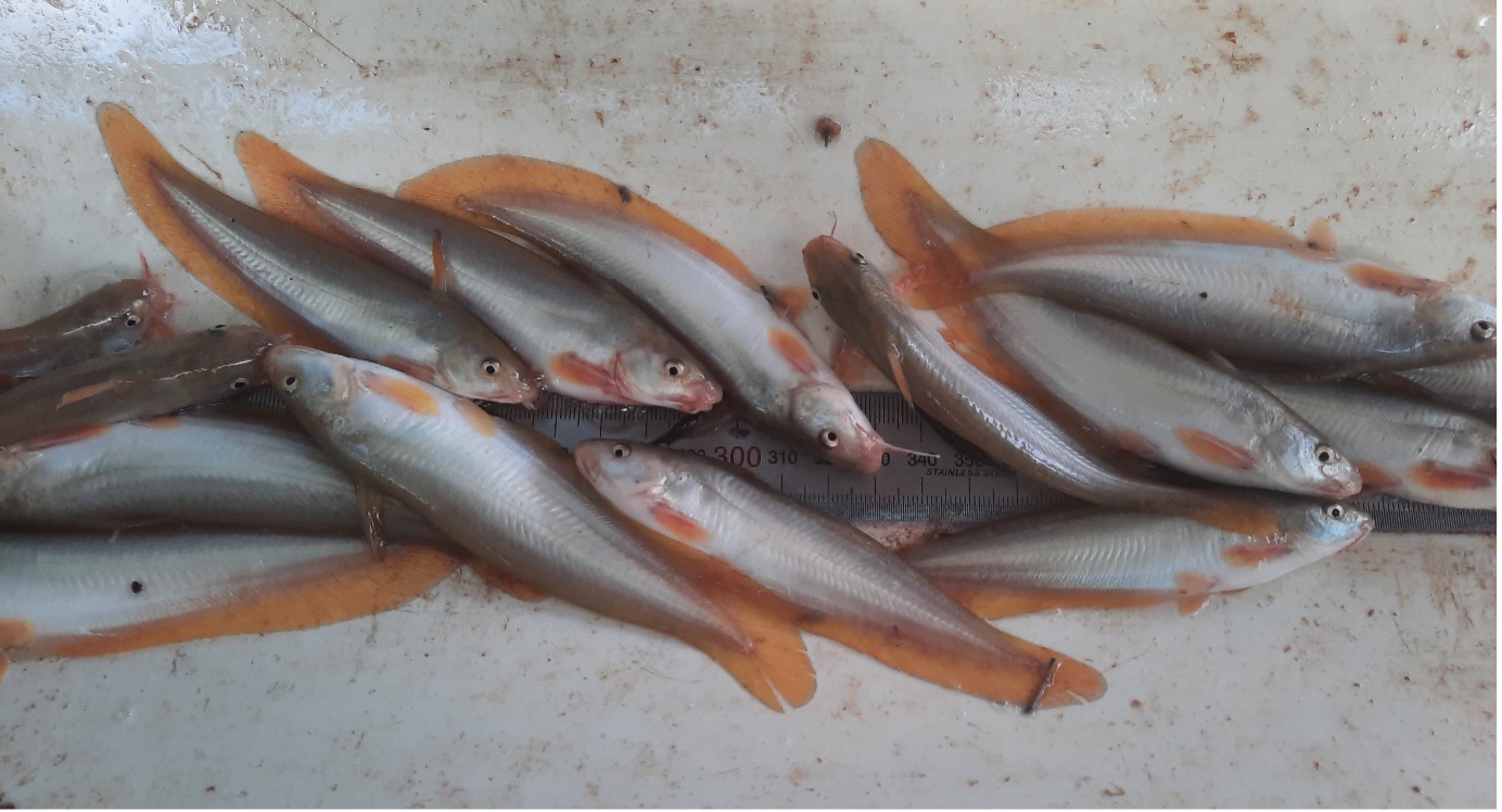
LTIM surveys in 2016 detected 788 Hyrtl’s tandan. As the lower Warrego dried, fewer Hyrtl’s tandan were observed. 101 individuals were detected in 2017, before only 10 individuals were counted from 2018 to 2020. With the return of higher flows, Hyrtl’s tandan have seen some recovery. 370 individuals were detected in 2022.
The 370 Hyrtl’s tandan detected in 2022 ranged in size from 75 mm to 255 mm (Figure 4). Given that Hyrtl’s tandan reaches sexual maturity when it is 130 mm to 140 mm in length, these results indicate that the individuals were mostly young-of-year (the previous year’s spawn) or were already sexually mature. The results indicated that recent natural recruitment had occurred.
What is natural recruitment?
In population ecology, natural recruitment describes the process by which new individuals are added to a population; in this case, the population of Hyrtl’s tandan in the lower Warrego River. Natural recruitment can occur as individuals are born and become sexually mature, or by the immigration of individuals into the population.

Whilst common to northern and central Australia, in the Murray-Darling Basin Hyrtl’s tandan is only present in the Warrego, Paroo (PaaRu) and Condamine Rivers. Accordingly, the preservation of Hyrtl’s tandan in the Warrego is critical for its long-term existence within NSW. As LTIM and Flow-MER have observed, the preservation of Hyrtl’s tandan is aided greatly by the contribution of Commonwealth water for the environment.
Managing water for the environment is a collective and collaborative effort, working in partnership with communities, private landholders, scientists and government agencies – these contributions are gratefully acknowledged.
We acknowledge the Traditional Owners of the land on which we live, work and play. We also pay our respects to Elders past, present and emerging.

