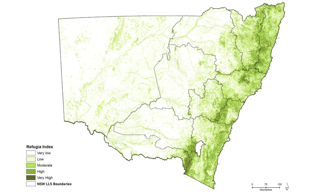


2rog conducted spatial analyses to identify 5-year trends in vegetation cover, vegetation connectivity, and private land conservation at NSW and Local Land Services regional scales. We also developed a state-wide refugia layer that mapped out climate and wildfire refuges, and a state-wide revegetation layer that prioritised places in the landscape in which revegetation could be employed to improve connectivity. The findings from this initiative will contribute to optimising the strategic placement of future conservation areas, with the goal of enhancing landscape resilience in the future.

